
Worth knowingCountry buses can be thin in the evening and on Sundays. Check when the last bus back leaves before you set off walking, not when you reach the village.
Arriving by rail
Two stations make a car-free visit simple. Moreton-in-Marsh sits on the Cotswold Line, which runs from London Paddington through Oxford toward Worcester, and the station is a short walk from the town's broad main street. Kingham, one stop earlier on the same line, is another handy arrival point for the northern villages. Kemble, in the south, lies on the line between Swindon and Gloucester and is the usual rail gateway for Cirencester, a few miles away.
Pick one town as a base and stay put. Moreton works well for the north, with Stow-on-the-Wold, Bourton-on-the-Water and the Slaughters all close by. A base with a station saves hauling luggage onto buses, and a single light bag makes the walk from the platform easy; the packing ideas in one bag for two weeks suit a Cotswold trip well. Ticket types and the habits that make rail days calm are the same as anywhere, and Europe by train covers them.
Buses between the villages
Local buses link Moreton, Stow, Bourton and other towns on routes that serve shoppers and schoolchildren as much as visitors. Frequencies are modest, with gaps of an hour or more on many routes, and fewer buses or none in the evening and on Sundays.
Treat the bus as the way out and walking as the way back, or the reverse. A bus to one village in the morning, a walk through the fields to the next, and a bus home from there makes a gentle day with no backtracking. Keep a little flexibility: if you miss a connection, a pub bench or a churchyard wall is a fine place to wait, and taxis can be called from the larger towns.
On a short visit, two walking days and one slower day make a good rhythm: the Stow and Slaughters walk, a section of the Cotswold Way, and an unhurried look at a market town such as Chipping Campden or Cirencester, which was an important Roman town and has a large parish church built on wool money.
Stow-on-the-Wold to the Slaughters
Stow sits high on its hill, its market square ringed by stone houses and inns, a reminder of the fairs and wool markets that made it rich. Before leaving, look at the north door of St Edward's Church, framed by two old yew trees that seem to grow into the stonework. From the edge of town, waymarked public footpaths drop south-west across the fields toward Lower Slaughter, a walk of an hour or two at an easy pace depending on the route you choose.
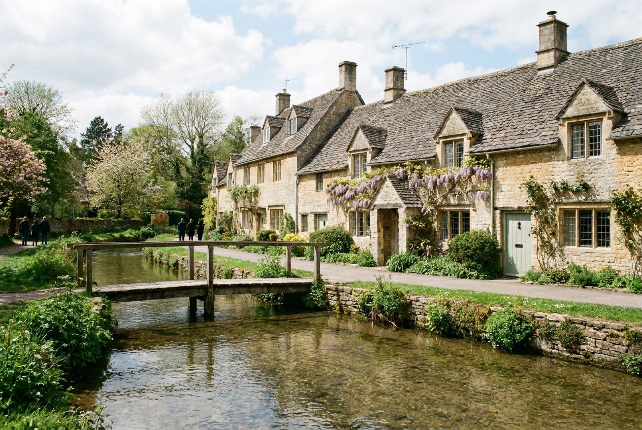
Lower Slaughter is built along the little River Eye, crossed by low stone footbridges, with a restored watermill at the edge of the village. From there a path follows the stream through meadows to Upper Slaughter, about a mile upstream, quieter and set on a slight rise. Despite the name, nothing grim happened here; it is usually traced to an Old English word for a muddy or marshy place.
 Pairs well withThe Dingle Peninsula loop, taken slowly
Bourton-on-the-Water, busier and threaded with footbridges over the River Windrush, is an easy walk south of Lower Slaughter and has bus connections back toward Stow and Moreton. Arrive late in the afternoon and the crowds have often thinned.
Stiles, kissing gates and the Cotswold Way
England's public footpaths cross private farmland by right, marked with small arrows on posts and fingerposts at junctions. You will climb over stiles, push through kissing gates and share fields with sheep and sometimes cattle. Close gates behind you, keep to the line of the path across crops, and give cattle a wide berth, especially cows with calves. An offline map on your phone or a paper walking map helps where a sign has fallen or the path crosses a large field.
The Cotswold Way is the long-distance version: a National Trail of about a hundred miles from Chipping Campden in the north to Bath in the south, following the western edge of the hills. You do not need to walk all of it. Short sections near Chipping Campden, with its long curving high street and arcaded market hall, or the climb to Broadway Tower, make fine single days, with wide views west from the escarpment as the reward.
The colour of the stone
What ties the region together is the local limestone, which ranges from pale cream to a deep honey gold depending on where it was quarried. It is used for walls, stone-slate roofs, barns and churches alike, so whole villages look as though they grew out of the ground beneath them. Late-afternoon light brings out the warmest tones, which is another reason to stay overnight rather than come for a day. Many of the larger churches were paid for by the medieval wool trade, and their size compared with the villages around them shows how much wealth sheep once brought here.
Look at the field boundaries as you walk, too. Dry-stone walls, built from the same stone without mortar, divide the farmland across the hills, and keeping them standing is a craft still taught and practised. At the edges of villages, old stone stiles set into the walls have been worn smooth by generations of boots.
Come outside the school summer holidays and the lanes are calmer, for the reasons given in why spring and autumn suit Europe best. Weekends bring more visitors to Bourton and Bibury than weekdays do. Buy a picnic from a town bakery and eat it on a bench by a stream; eating well on the road has more on simple, good meals like that.
Filed under getting around.